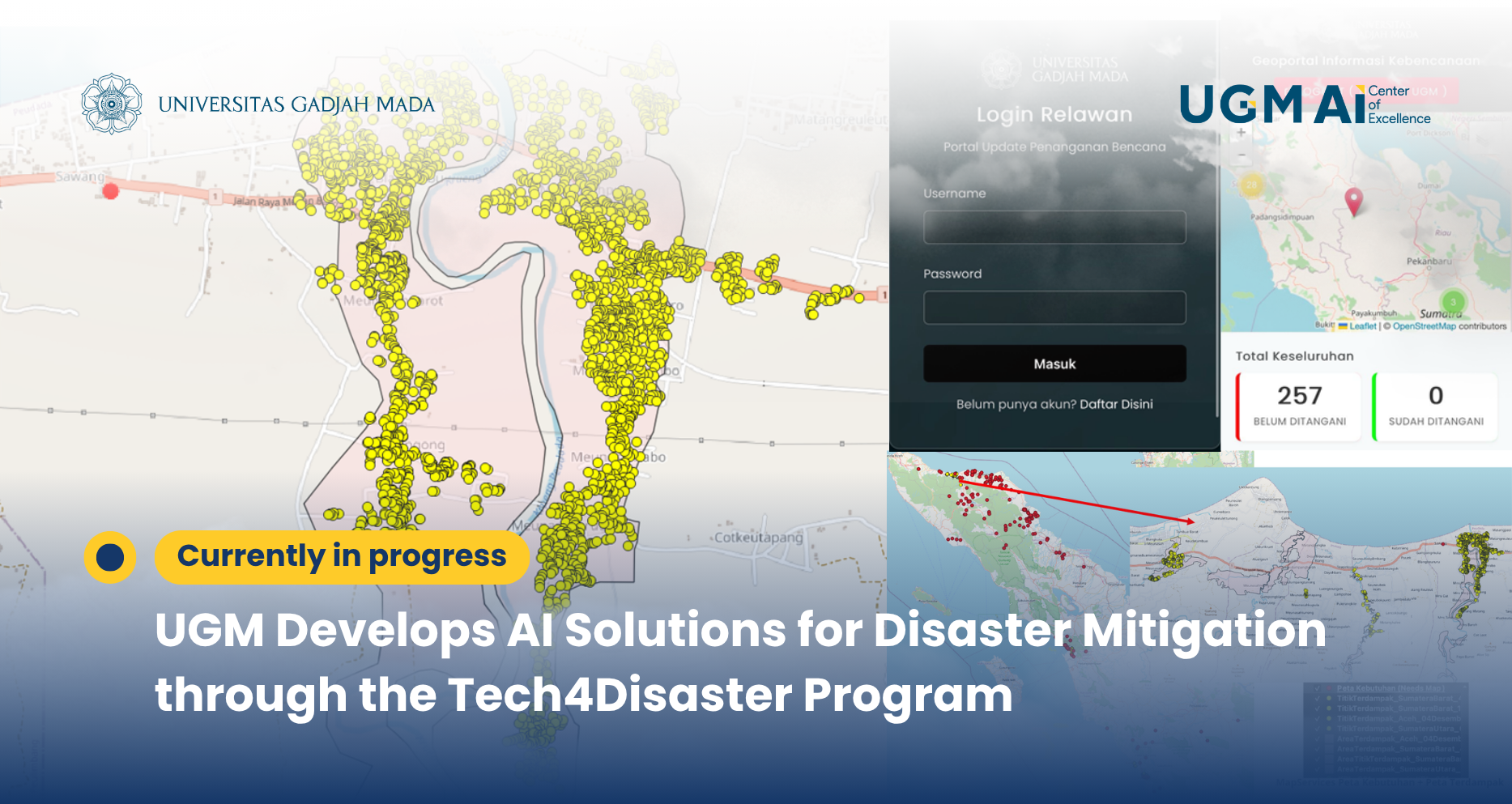
Yogyakarta – Universitas Gadjah Mada (UGM), through its Faculty of Geography team, has introduced an artificial intelligence (AI)-based innovation under the AI for Climate program through the Tech4Disaster use case—an integrated solution for disaster and landslide mitigation.
This program is driven by Indonesia’s high vulnerability to various natural disasters, which necessitates a transformation from reactive disaster response approaches to more proactive, integrated, and data-driven systems.
Technology-Based Disaster Management Transformation
Through the Integrated Smart Disaster Management approach, the Tech4Disaster solution integrates several advanced technologies, including:
- Geospatial Technology (GIS)
- Internet of Things (IoT)
- Big Data
- Artificial Intelligence (AI)
This integration enables environmental signals to be processed into real-time spatial information that supports fast and accurate decision-making.
The Tech4Disaster solution is built on a system architecture consisting of four main components:
- Sense (IoT)
Real-time data collection through field sensors, drones, and community reports.
- Store (GeoBigData)
Centralized storage for large-scale spatial, historical, and demographic data.
- Think (GeoAI)
Utilization of machine learning for:
- Disaster risk prediction
- Automated damage classification
- Act (Geospatial/GIS)
Visualization through dynamic maps, decision-making dashboards, and evacuation route optimization.
This approach enables faster response times while supporting long-term, data-driven planning.
Participatory Mapping and Rapid Response
One of the key innovations in this program is participatory mapping (needs mapping), which allows communities to directly report field conditions through digital platforms.
Additionally, the system supports:
- Rapid mapping based on satellite imagery
- Mapping of flood- and landslide-affected areas
- Real-time monitoring dashboards
As a result, aid distribution and evacuation processes can be carried out more accurately and effectively.
Advanced Analytics with AI
In terms of analytics, Tech4Disaster leverages deep learning models such as Prithvi-EO-2.0, which is based on the Vision Transformer architecture, to detect potential landslides from satellite imagery.
This model is trained using thousands of polygon datasets derived from manual interpretation, enabling it to:
- Identify landslide-prone areas
- Detect environmental changes
- Support post-disaster analysis
Case Study and Implementation
The implementation of this solution has been carried out in several regions across Indonesia, including Aceh (Bener Meriah Regency) as a case study area.
Through the use of satellite data and AI, the team successfully:
- Mapped affected areas
- Identified building damage
- Compared pre- and post-disaster conditions
Towards Climate-Resilient Communities
The Tech4Disaster program aims to:
- Reduce disaster risks and casualties
- Accelerate rehabilitation processes
- Support sustainable spatial planning
- Build climate-resilient communities
This initiative also aligns with the achievement of the Sustainable Development Goals (SDGs), particularly in disaster resilience and sustainable development.
By integrating AI, geospatial technologies, and community participation, UGM—through Tech4Disaster—demonstrates that technology can be a key enabler in addressing the challenges of climate change and future disasters.
.